Bootle
Bootle is in Liverpool, north of the centre. Originally for the wealthy to avoid the masses in Liverpool, it was later popular with Irish dock workers.
The docks lie to the west of the town. Arguably a less attractive area, there is not much you can see of them as access is restricted.

Back from the docks is the north-south running Derby Road, A565. I assume the road is named after the Earl of Derby, and not because it goes to the city - he will crop up again.
This is a major service road for the docks, and there are some examples of the office buildings of the old dock companies.

As well as facilities for the dock workers.... Many now closed.

I also found the Garden of Rest. This was the site of St Mary's Church, which had its own graveyard. I think the church was bombed during the war, and there is nothing of it now, but apparently the graves are still there.

Note how brown the grass is; we have not had rain for several weeks.
Behind Derby Road is the Leeds Liverpool canal.


I was struck by how rural it suddenly feels as soon as you are on the tow path. Though there is a distant grumble of traffic, the predominant sounds are the several species of birds. As well as the cygnets, I also saw moorhen chicks.
Behind the canal is the railway to Southport. Bootle boasts two stations, this is Bootle New Strand.

The clock has quite a 20s vibe to it, and I wondered if that was a remainder from an earlier station, but I have not found evidence of that.
The station takes it name from the nearby New Strand Shopping Centre, which opened in 1968. Previously it had been Marsh Lane, and then Marsh Lane and Strand Road.
Next door is what used to be St George's Tavern.

We are now in the centre of Bootle, and pubs and ex-pubs are are everywhere! Just up Marsh Lane is the Jollys, previously the Jolly Farmers.

Behind Jollys is the New Strand Shopping Centre that gives it name to the station. This is actually the view from the far side.

It is a fair size, and looked well used, though the end nearest in the photo is closed for redevelopment, and maybe they moved all the shops from that section to fill in the empty shops elsewhere.
Continuing along Marsh Lane, there are gas holders, presumably empty, given they are deflated. Why are they still there? There was a gas works here on both sides of the road, and that is gone.

And then the road crosses the canal... Wait, we did the canal before! Well, it snakes around following the contours, and in south Bootle it is between Derby Road and the railway, but it cuts across, and to the north is rather more to the east.

A map of 1905 indicates there was a railway tunnel running under - and following the line of - Marsh Lane at this point, which must have gone under the canal, at the same point the road went over it.
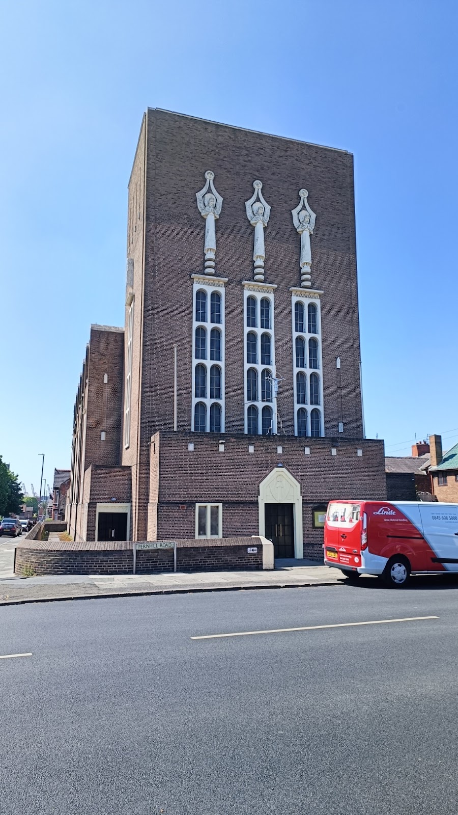
Marsh Lane becomes Aintree Road, and we go right down Fernhill Road, and find Bootle Roman Catholic Church. A lot of Catholic churches were built of brick, but few are as striking as this one.
On the left side of the church is Derby Park.

The wall on the left is, I think part of a bridge. There was a lake here at one time, with an island and two bridges. The lake was drained in the mid-fifties.
At the southeast corner is a rather fine lodge.

Heading back west, is the curiously names Jawbone Tavern on Litherland Road.

And the Merton Inn, which looks to be closed.

Turning left down Oriel Road we go past the other station, and then the impressive town hall, now home to Sefton Metropolitan Borough Council.

And in stark contrast, across the road is this tiny newsagent.


Comments
Post a Comment