Deansgate, Manchester
I was in Manchester for just a few hours, so only really scratched the surface; it is a big city!
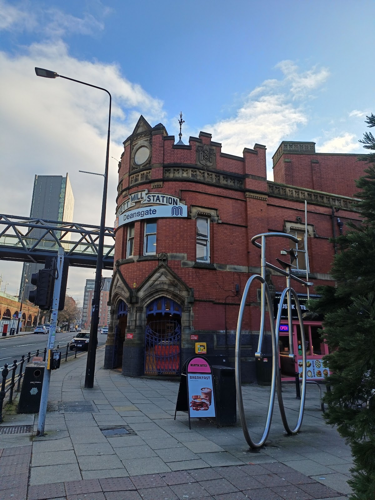
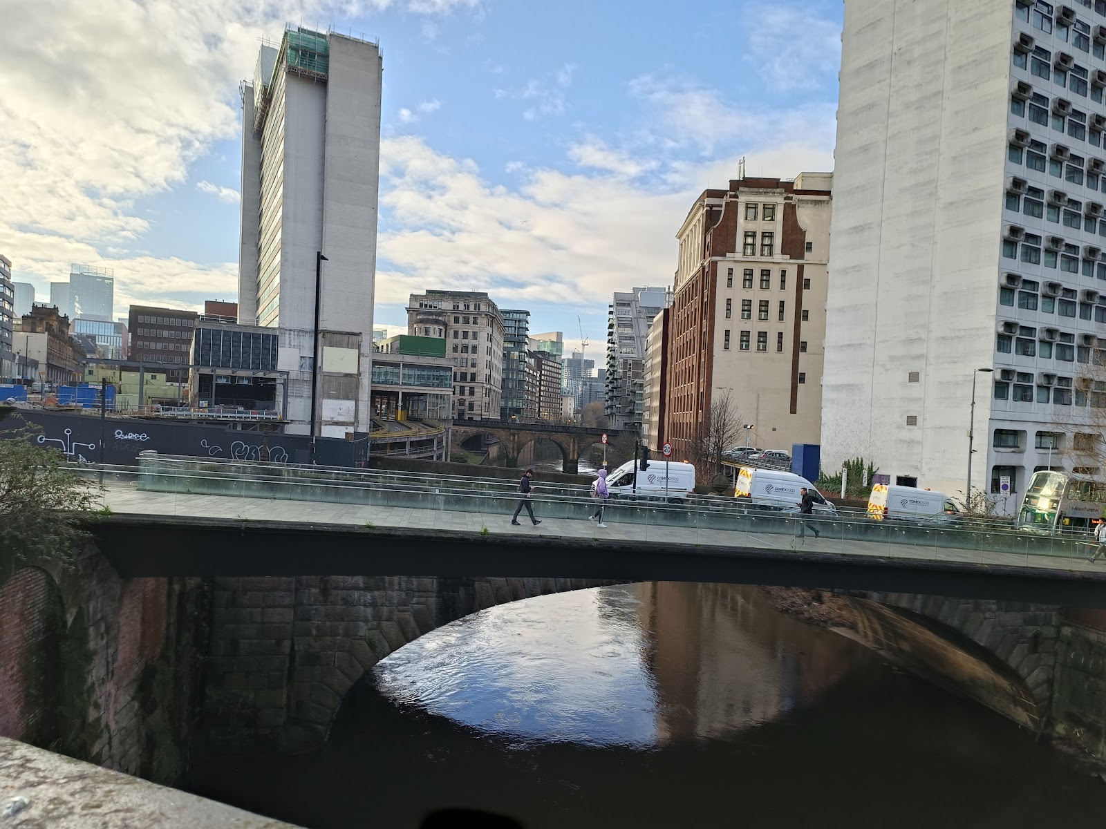
I arrived at Deansgate Station, from Preston. The line was built in 1849, and crosses a number of impressive bridges over roads and canal just before the station.

The area west of Deansgate is Castlefield, so named because of the Roman fort, the remains of which can be seen from the train. I did not walk that way, but this view is looking along the canal towards Castlefield.

The image above is taken from the re-purposes remains of a warehouse, shown below. You can see where barges would be admitted into the building in the image below. The ground-floor window frames are still there but everything higher has been removed.

Deansgate Station was originally called Knott Mill and Deansgate, but everyone just called in Knott Mill, so when the station was rebuilt in 1896, it was renamed Knott Mill. It became Deansgate in 1971.
Heading east, parallel to the railway, there is the City Road Inn, an interesting building with a curved frontage and a turret.

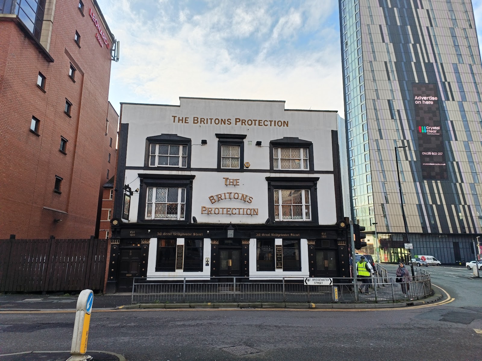
I headed northeast from there, past the Briton's Protection. Built in the early 1800s, the name comes from it being used to recruit soldiers for the British army.
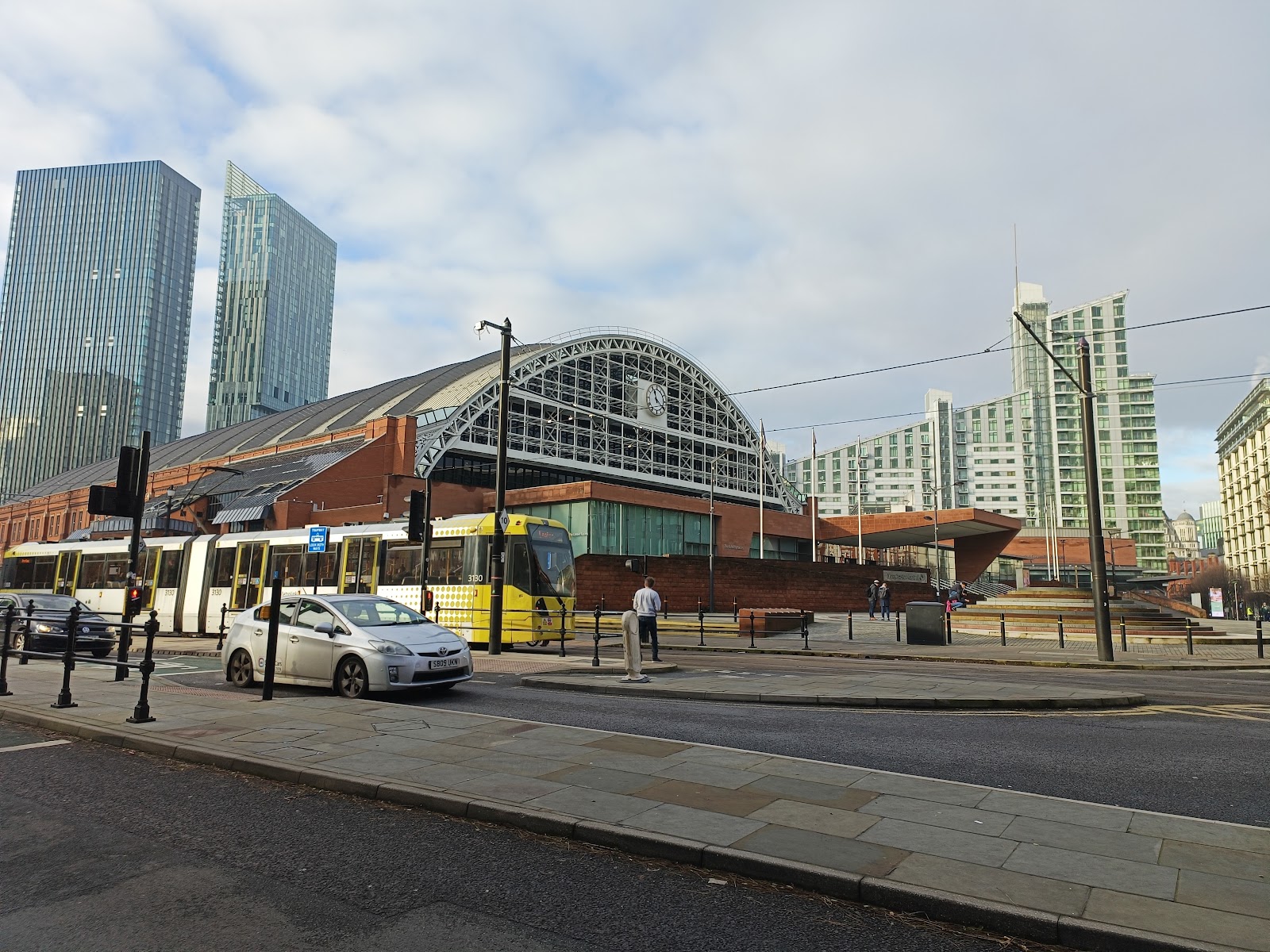
Further on, to the left is the old Manchester Central Station, built in 1880. It is now an exhibition centre; formerly GMEX, now Manchester Central.
Just beyond the exhibition hall is the Midland Hotel, built by the Midland Railway company, one time owners of the station, in 1903.
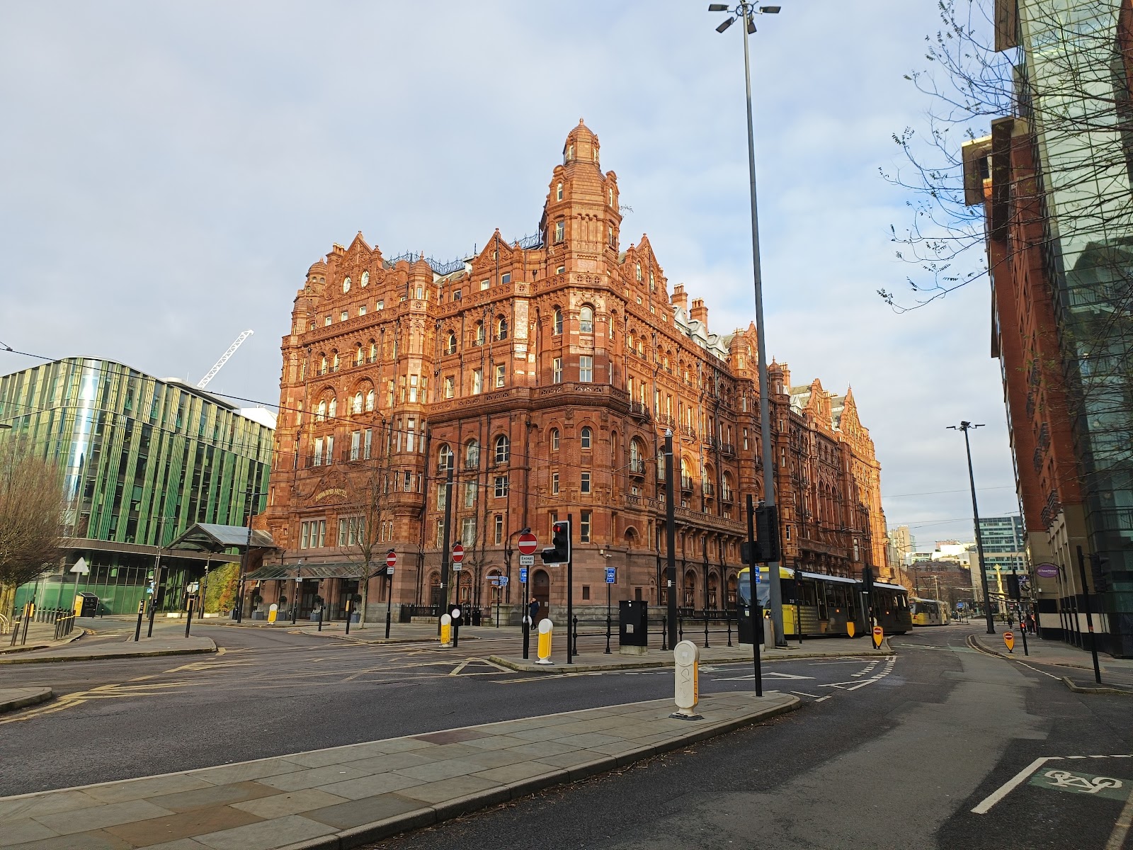
There is a theory that such was a the opulence of the hotel Hitler planned to use is as a headquarters after conquering Britain, and so the area was off-limits to Germany bombers during the war.
Beyond the hotel is the Central Library, a round building in neo-classic style.

Beyond that is the town hall, undergoing serious renovation when I was there, but you can see part of it to the right in the image above.
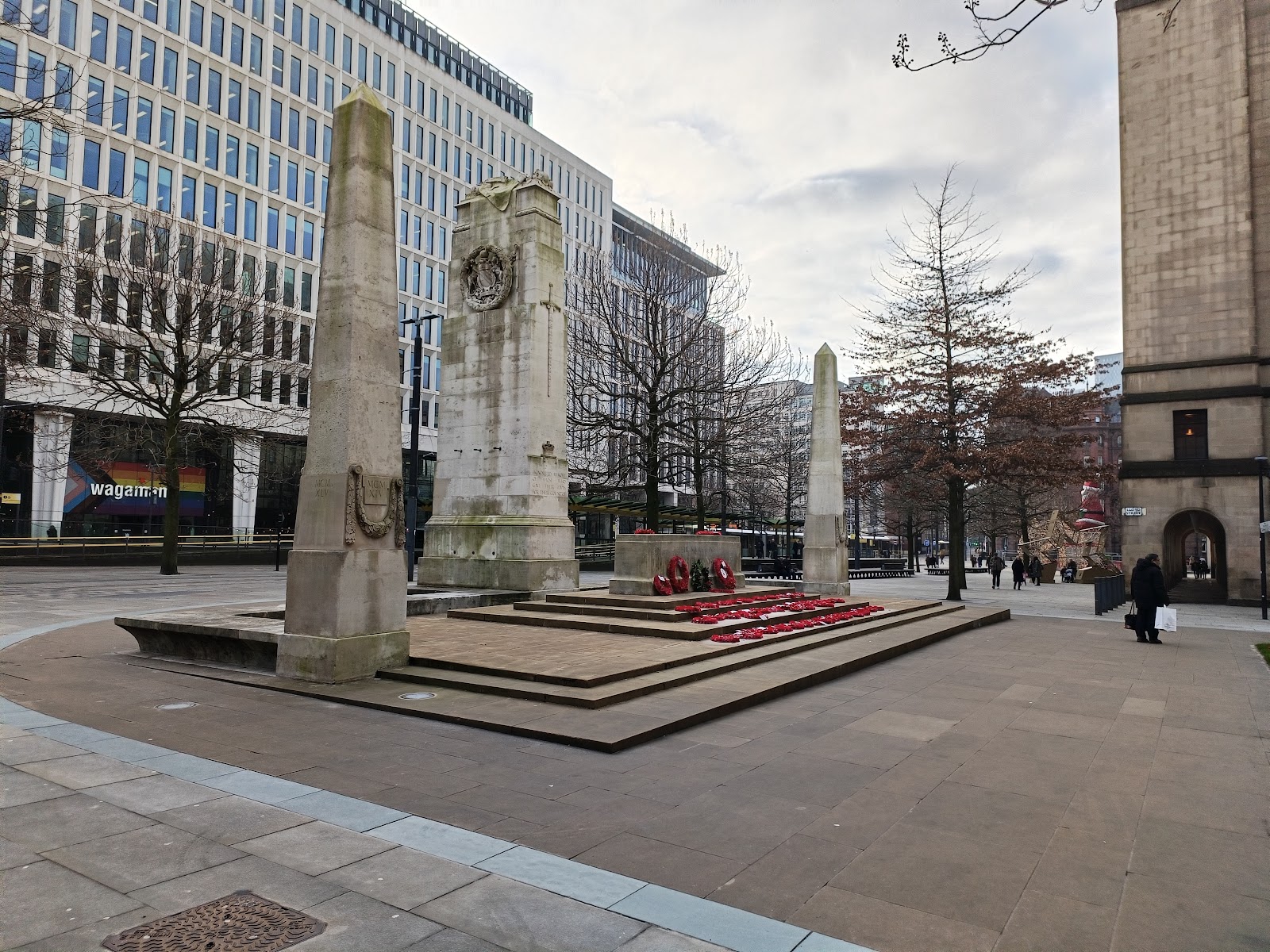
The area this side of the town hall is St Peter's Square, an important interchange on the trams, and the cenotaph is adjacent to it.
On the other side of the town hall is Albert's Square, but that was closed off as part of the work on the town hall.
John Dalton Street now takes us west, and back to the north end of Deansgate, named after the nineteenth century scientist who taught in Manchester for several years.
The Ape and Apple pub is on the south side of John Dalton Street, and directly behind that is the "Hidden Gem", a Roman Catholic church that is so well hidden I failed to see it...
. 
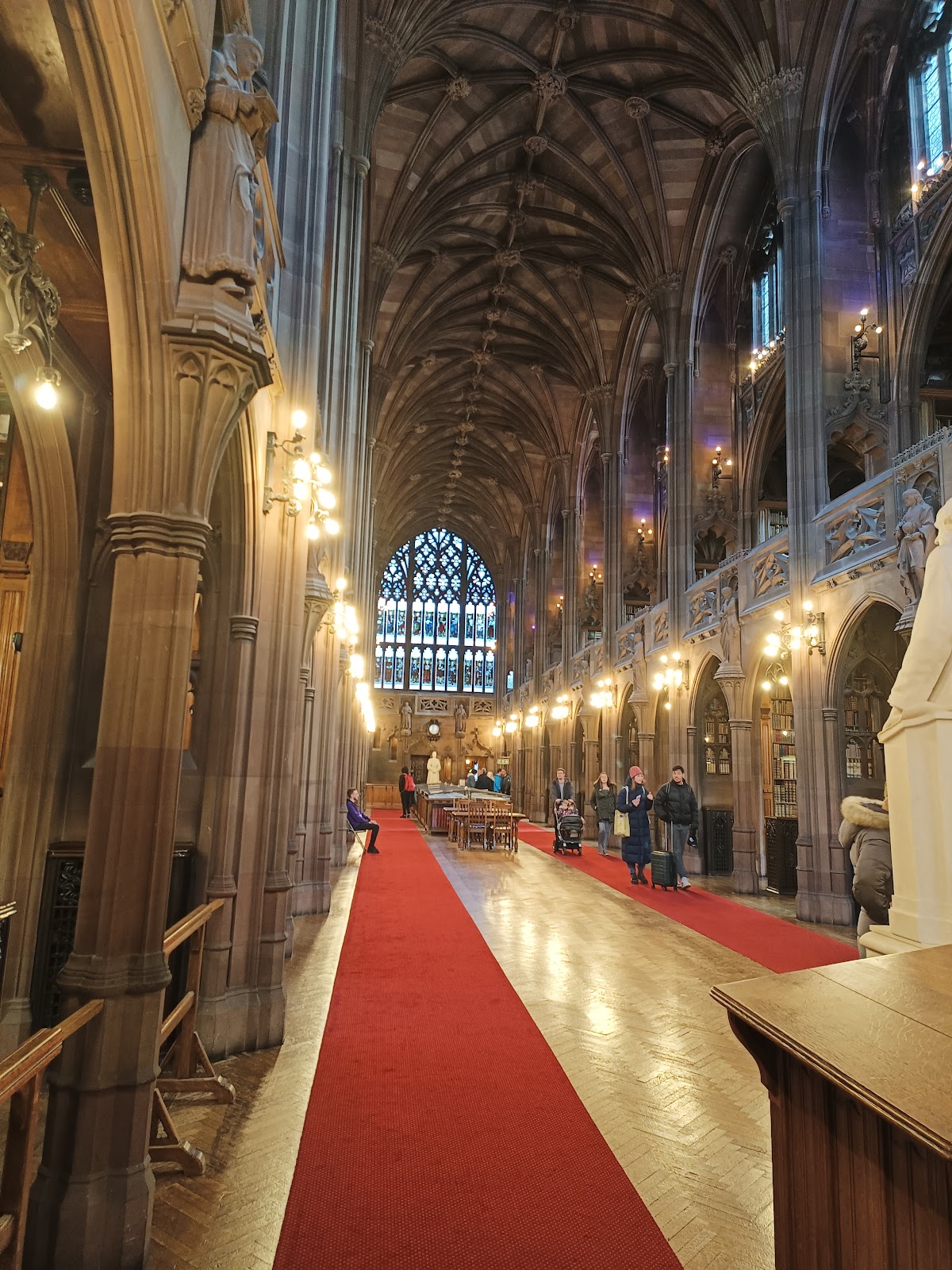
Now on Deansgate, this is the John Rylands Research Institute and Library, a very impressive, if somewhat grubby, gothic building that opened in 1900.

It is free to enter and have a look around. It was apparent used as inspiration for Hogwarts in the Harry Potter movies; it is not unlike a cathedral inside...

Near door to the Rylands in the Lost Dene pub. Deansgate takes it name from the River Dene, which no longer exists (as opposed to just being covered over) but was probably at the north end of the road. The pub references the river now being lost.

And then the Sawyers Arms, very much a traditional city pub, with the door on the corner.

Further up Deansgate is the House of Fraser, formerly Kendals, a very Art Deco building built in 1939.

A short way east of Deansgate at this point is St Anne's Square, with St Anne's church at the south end.

The square is the more upmarket shopping area.

At the north end is the very modern Marks and Spencer's.

Beyond that is Shambles Square, and the Old Wellington Inn, built in 1552.
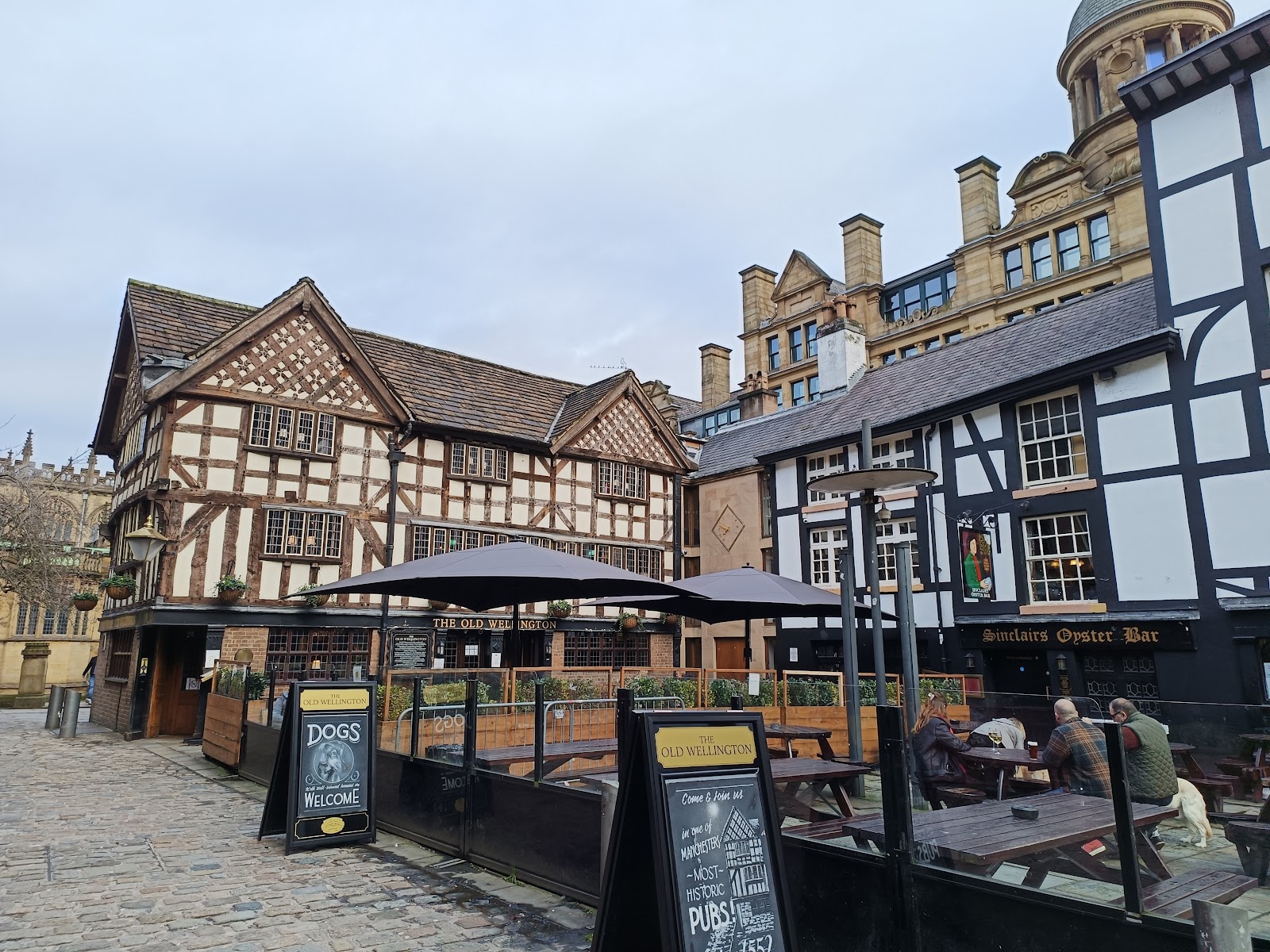
This is not where it was built - the pub has been moved twice to get to its current location. The first move, in 1971, involved raising it vertically 5 foot. This also involved considerable work to bring the building to modern standards. In 1997 it was moved 300 m to its present location, together with the Oyster bar, the building to the right in the image above. I think the second move involved dismantling and moving piece-by-piece, rather than moving it as a single unit.
There is a photo of them from 1983 here (about 40% down the page) in the original Shambles Square; back then the two buildings were in a row, rather than on sides of a square.
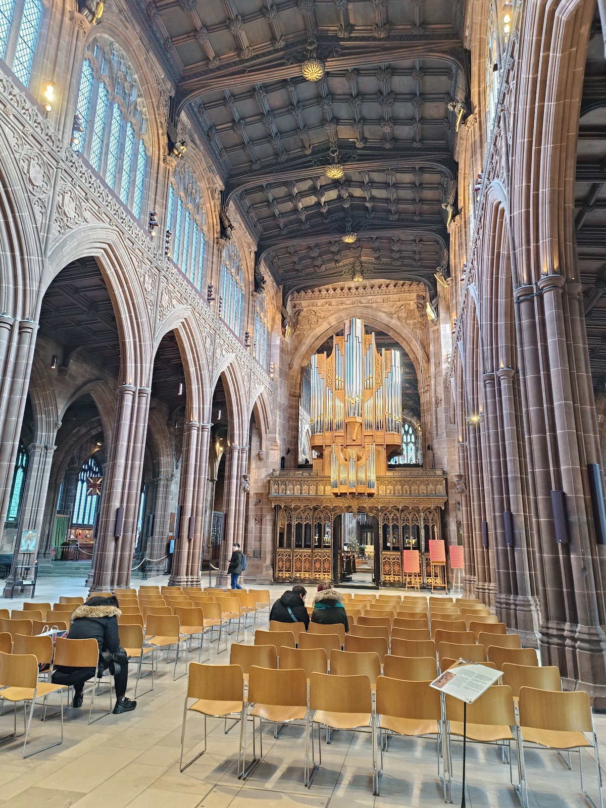
Just beyond the Old Wellington (and just visible on the left in the image above) is Manchester Cathedral. It dates - in part - from around 1421, but only became a cathedral in 1847; Manchester become a city six years later.

To the west of the Cathedral is the River Irwell. It is not the best feature of the city...
While southeast of the Cathedral is Manchester Arndale., built between 1972 and 1979. It was seriously damaged by the IRA bomb in 1996, and has been significantly refurbished as a result.

To the south of there, Primark, formerly Lewis's (not to be confused with John Lewis) is a delightful Art Deco building, though this replaced an even more fancy building according to here.

One last building of note, just across from Piccadilly Station, is the old fire station, built in 1906.

It closed in 1986, and was derelict for many years, but looks to have been given a new lease of life as hotel and leisure facilities from 2015.


Comments
Post a Comment